


Our Awards


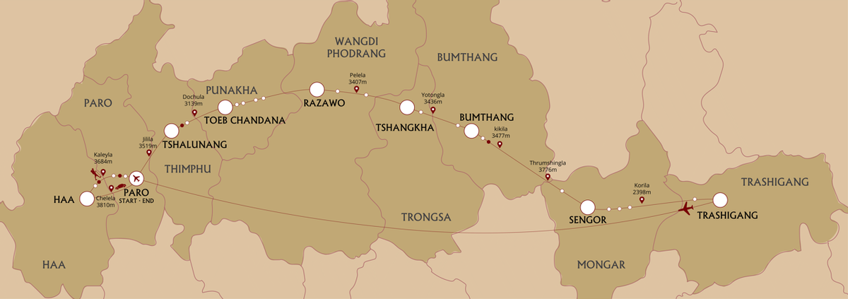
For the ultimate trekking experience in Bhutan, challenge yourself to complete the Trans Bhutan Trail end-to-end hike, one of the world’s greatest walks. Hike across the country from Haa in the west to Trashigang in the east, covering 403 kilometres on the way as you pass countless historical and religious sites, traverse diverse climate zones, and enjoy a variety of culturally immersive experiences. Rest days are programmed in Punakha and Bumthang.
On this trip you will be staying in a mixture of locally-owned 3* hotels as well as at our Signature Campsites. Our campsites include semi-permanent tents, showers, toilets, hot stone baths (where available) and locally sourced organic produce for dinner. If you would like to upgrade to 4* or 5* accommodation please get in touch.
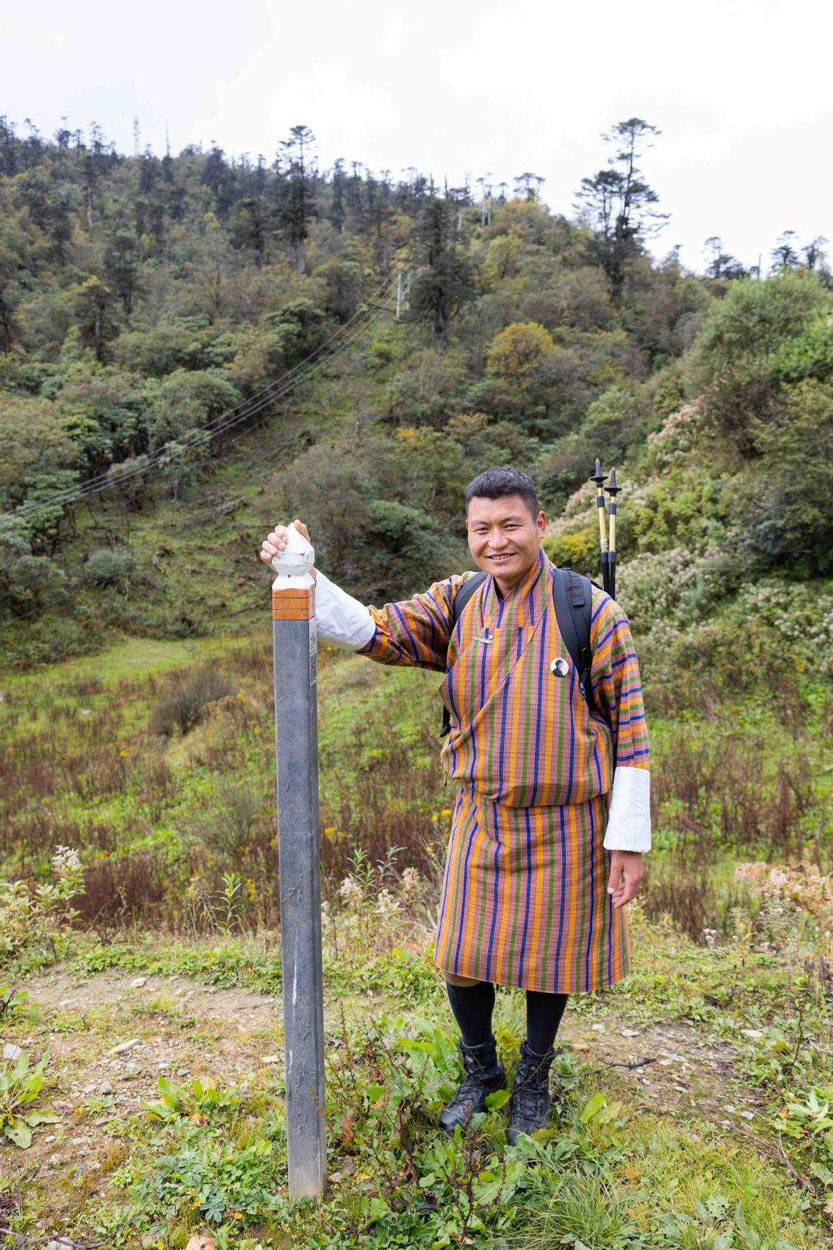
On arrival at Paro International Airport today, you will be met by your guide. You will be driven by private vehicle to the town of Haa, with a brief stop en route to take in some breathtaking Himalayan vistas at Chelela, a mountain Pass which at 3,810 meters (12,500 feet) above sea level is the highest paved road in Bhutan. As you arrive at Chelela, you may wish to join with your guide and driver in a hearty cry of ‘lha-geh lu!’ (‘May the Gods be victorious’).
Your guide will select a local restaurant in Haa for dinner this evening, which will be your first chance to learn about and sample Bhutanese cuisine.
Accommodation: Soednam Zingkha Heritage Lodge or similar (3*)
After breakfast this morning, join your guide for an acclimatization walk around the town. Your orientation walk will include a visit to the Lhakhang Karpo or ‘White Chapel’ complex, just south of Haa’s dzong (fortress). The Lhakhang has an atmospheric central chapel which houses statues of the Tse-la-nam Sum trinity. During your visit to the Lhakhang Karpo, you will have the option of a traditional pre-expedition blessing in preparation for your upcoming journey along the Trans Bhutan Trail.
The afternoon will be at leisure to relax or undertake some more gentle acclimatization walks with your guide.
Included Activities:
Accommodation: Soednam Zingkha Heritage Lodge or similar (3*)
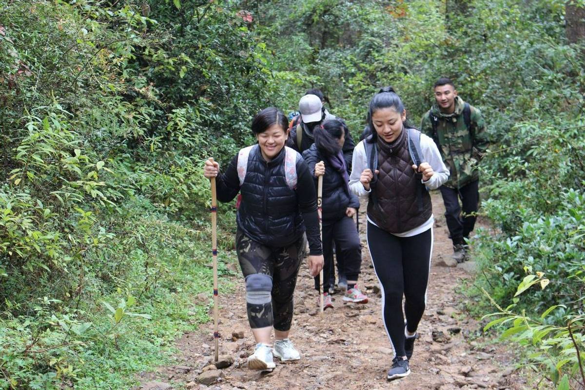
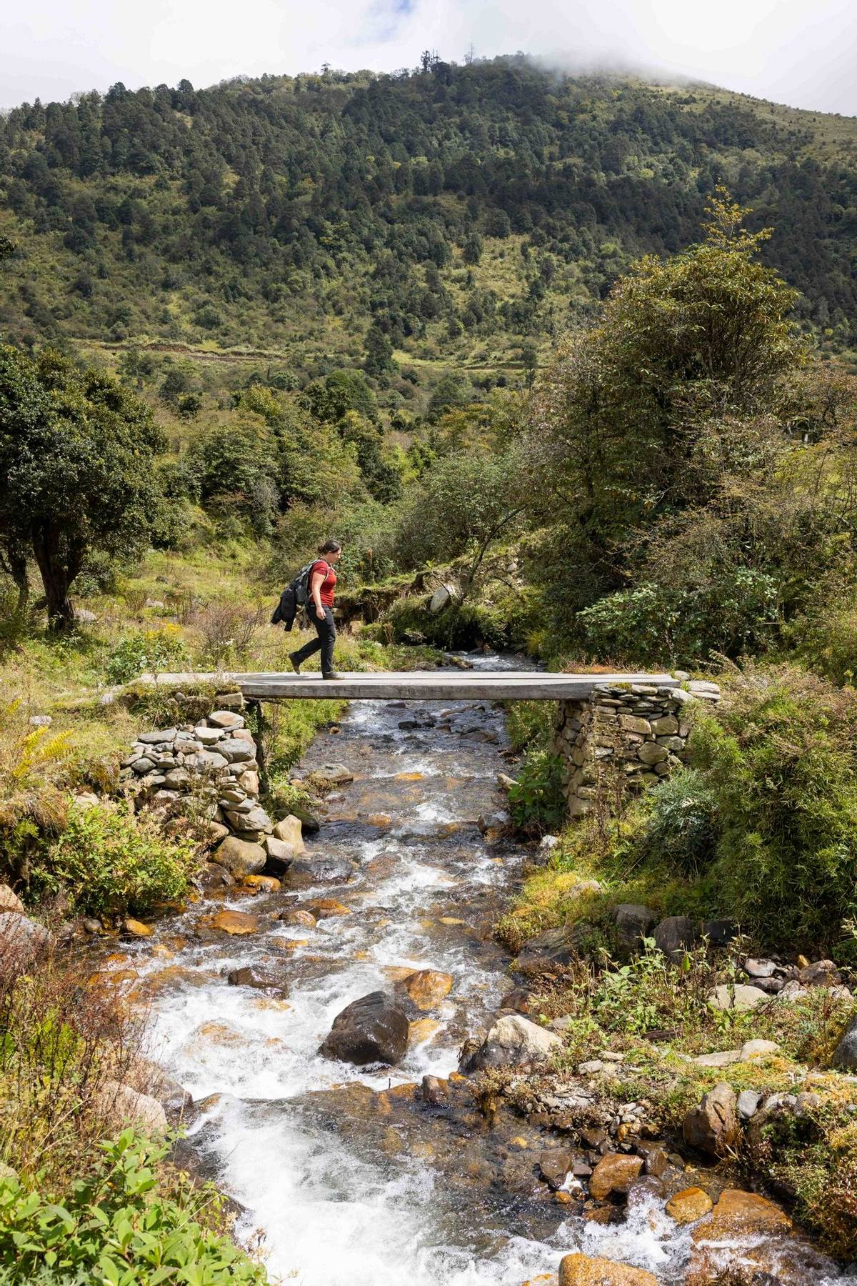
After breakfast at your hotel, you will be transferred to Katsho, where you will begin your first day of trekking on the ancient Trans Bhutan Trail. For generations, the people of Haa followed the route you will walk today to trade with the Parops in the neighbouring valley. There, they would barter 20 drey (approximately 30 kilograms or 66 pounds) of Shakam (dried meat) for 20 drey of rice at Paro Tshongdu (market) because the harsher climatic conditions in Haa are unsuitable for rice cultivation.
The age-old trail follows the beautiful Haa river as it gently rises out of the Katsho Valley, passing through yak pastures before heading into forests of pine and rhododendron. As you traverse the Katsho Valley, look out for cliff-edge Bjungneydra Taktsang (monastery), also known as “The Mini Taktsang”, and the sky burial site of Kungkarpo. The trail continues to climb until it reaches the Pass at Kaleyla, where it crosses the ridge trail between Chelela and Sagala.
At Kaleyla, you will enjoy stunning views of the Himalayan range to the north, including on the clearest days vistas of Mount Jhomolhari (7,326m/24,036ft), Mount Jichudrakey (6,662m/21,860ft) and Mount Tsherimgang (6,532m/21,431ft). You will be provided with a picnic lunch during this stop.
From Kaleyla, the trail descends through rhododendron and bamboo forest into the Paro Valley. The last few kilometres to Paro will then be on tracks which meander through traditional Bhutanese farming villages.
On arrival, check into your hotel where your guide will arrange for dinner either at your hotel or in a local restaurant.
Included Activities:
Accommodation: Metta Resort & Spa or similar (3*)
After breakfast this morning, rejoin the Trans Bhutan Trail heading east. The trail rises gently from Lamgong Village as it traverses the sprawling rice paddies of the Paro Valley, before carving around the northern ridge and descending into the traditional village of Dopshari. At Dopshari, enjoy a cookery demonstration and a traditional Bhutanese lunch at a local farmhouse. After lunch, you will also have the opportunity to try your hand at Bhutan’s national sport, archery, and have a quick game of traditional ‘khuru’ (darts).
After lunch, head out onto the trail for one last time for the climb up to Upper Dopshari (Damchenang), where you will end you hike with stunning views out over the Paro Valley.
Head to your hotel, where we recommend you to relax and unwind.
Included Activities:
Accommodation: Metta Resort & Spa or similar (3*)
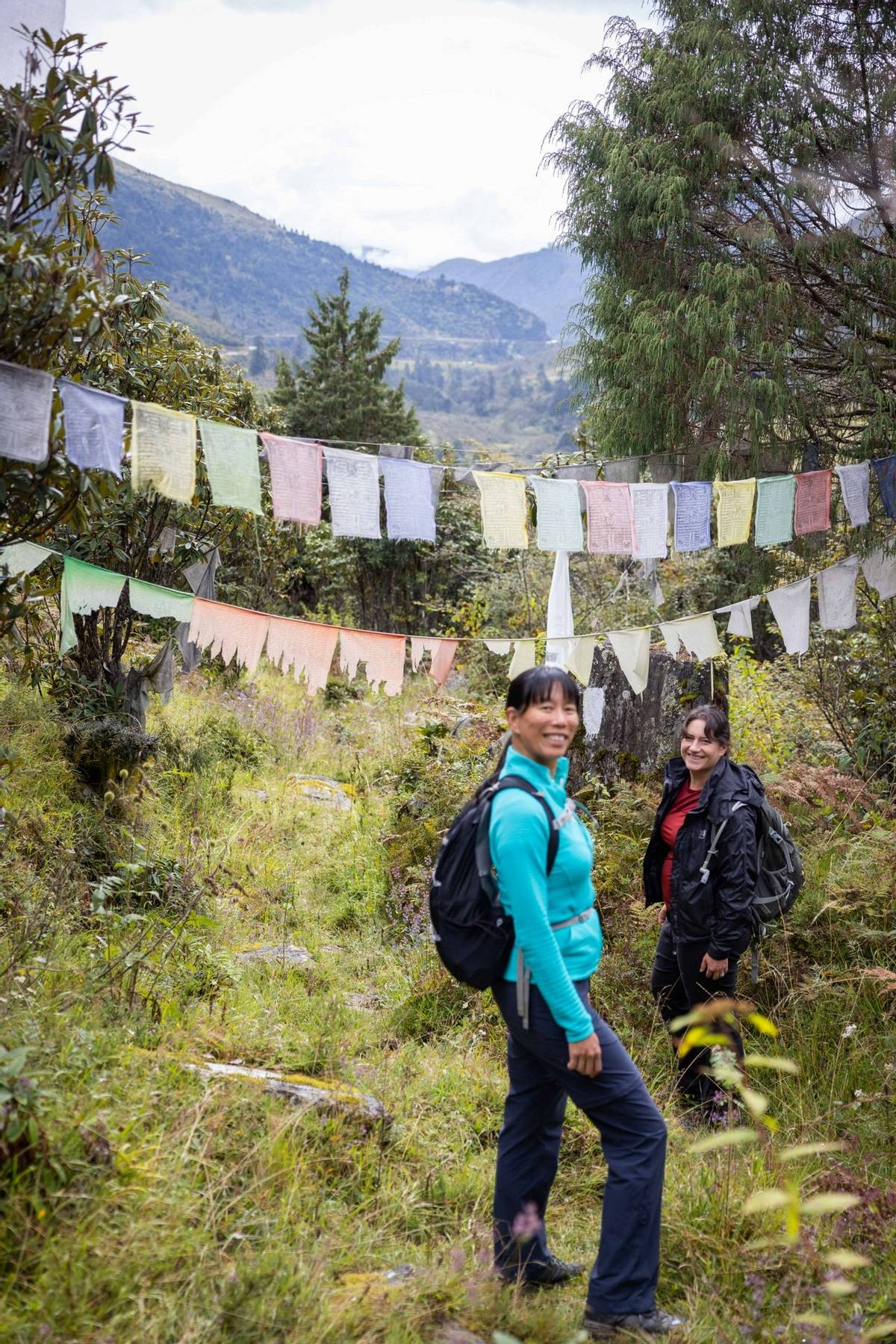
After breakfast today, rejoin the Trans Bhutan Trail heading east towards Tsalunang. Today’s trek begins with a climb from Upper Dopshari through community reforestation projects, small farming villages, into deep forest and along pristine rivers. You may well find the perfect spot to hoist some lungdhar (prayer flags) on your way.
After a picnic lunch at the Pass at Jela, if time permitting, you may wish to make the small detour to visit Jela Dzong (fortress). Built on the site where Zhabdrung Ngawang Namgyel is said to have encountered the protective deity Pal Yeshey Goenpo on his pilgrimage to Paro, its main relics are the statues of Du Sum Sangye (Buddha of the Past, Present and the Future). It is believed that the Buddha once faced northwards but then miraculously turned itself to face southwest towards Paro.
From Jela, the trail drops gently down into the Tsalunang Valley, passing through forests of blue pine and rhododendron on its way. Bird watching enthusiasts will want to keep an eye out for some of Bhutan’s beautiful species on this section.
A dinner prepared from organic, locally-sourced produce will be provided at camp.
Included Activities:
Accommodation: Deluxe Camping
After breakfast at camp, continue your hike east towards Bhutan’s capital city, Thimphu. With elevations ranging between 2,248 metres (7,375 feet) and 2,648 metres (8,688 feet) above sea level, Thimphu is the fifth highest capital city in the world by altitude. It is also the only capital city in the world without any traffic lights. The city offers a unique blend of the modern world with Bhutanese tradition.
From Tsalunang, the trail climbs through forests of fir, blue pine, dwarf rhododendron and through yak pastures before it reaches the Pass at Pumola, which, at 3,994 meters (13,104 feet) above sea level, is the highest point on the Trans Bhutan Trail. Herders from Punakha would once bring their cattle here over the summer to escape the heat of the lower-lying Punakha valley.
After enjoying a picnic lunch and excellent mountain views at Pumola Thabzakha, rejoin the trail as it meanders down through picturesque meadows, offering stunning views of the Thimphu Valley from the long ridge thereafter. From here, you will be able to make out your route for the next few days in the distance beyond Thimphu. Towards the end of the day, you will arrive at Buddha Point, home to Thimphu’s most recognized landmark, the Buddha Dordenma. Guarding the entry to the Thimphu Valley, this 51 metres (167 feet) gilded bronze statue is filled with 125,000 miniature statues and sits atop a three-storey base housing a chapel and thousands of donated statuettes. The statue was commissioned to mark His Majesty the Fourth King of Bhutan, Jigme Singye Wangchuck’s 60th birthday.
Check in to your hotel before heading out for dinner with your guide at one of the many excellent restaurants in the capital.
Included Activities:
Accommodation: Tashi Yoedling or similar (3*)
After breakfast at your hotel, head back to Buddha Dordenma to rejoin the Trans Bhutan Trail. Before the National Highway was built, the section of the trail which you will follow today would have been a busy thoroughfare connecting Thimphu with Punakha and, beyond it, the east. From here, you will descend via the Debsi Valley. After crossing the river on the motor road bridge, you will follow the old east-west highway through the town of Babesa, until you reach Simtokha Dzong (fortress). Built in 1629 by Zhabdrung Ngawang Namgyal, the fortress is said to sit on the site where a demon once vanished into a rocky outcrop. Simtokha Dzong (fortress) is said to be the first fortress in Bhutan built to house both administrative and monastic residents, and it is also the oldest dzong to have survived as a complete structure. The Dzong boasts many fine murals, carvings and tapestries, a three-storey utse (tower), and a number of chapels.
From Simtokha, the trail continues to rise steadily as it traverses orchards, strawberry fields, and market gardens. Upon arrival in Hongtsho, end your hike for the day and join the vehicle to drive back to the hotel.
Dinner will be at your hotel this evening.
Included Activities:
Accommodation: Tashi Yoedling or similar (3*)
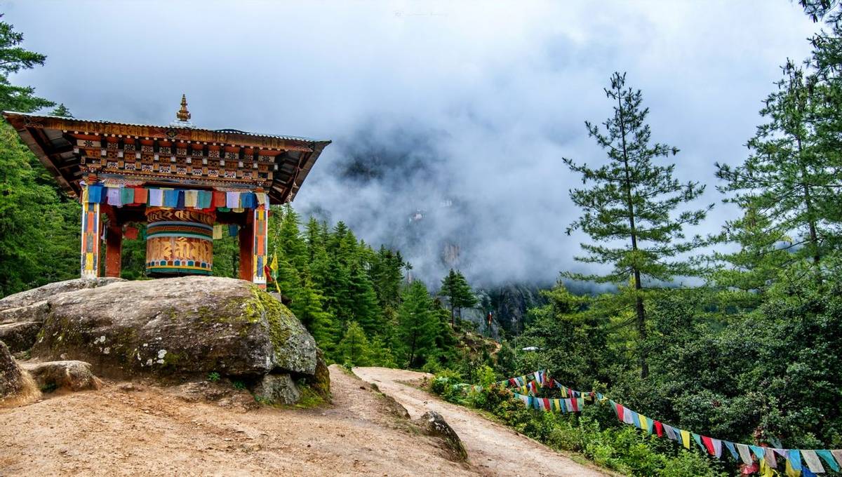
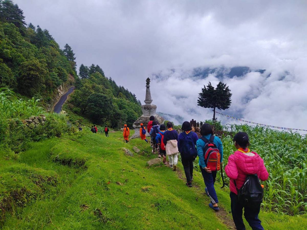
After breakfast at hotel, head back up to Hongtsho, from where the branches off into dense forest and across meadows. Eventually, the trail will reach Dochula, a mountain Pass at 3,116 metres (10,224 feet) above sea level. Mountain passes are some of the most sacred places in Bhutan and so it is customary to burn incense as an offering in places such as this. You may also wish to join locals in hanging colourful prayer flags as a sign of respect to the Gods.
Dochula offers one of the most spectacular sunrises anywhere in Bhutan and so we recommend rising early this morning. At clearer times of the year, you enjoy panoramic views of the Himalayan range in the distance as the sun rises. You should also visit the Druk Wangyal Chorten (stupa), also known as the ‘108 Chortens’, and its nearby meditation caves.
After a short break at the Pass, embark on a historic journey and head down into the adjacent valley and join a section of the Trail known as the ‘Divine Madman Trail’. You are now following in the footsteps of the Divine Madman himself, Drukpa Kuenley, when he came to Bhutan from Tibet in the 16th century to fulfil his destiny of suppressing evil energies. Over the coming days, you will come across a number of important cultural sites and extraordinary stories related to the life of Drukpa Kuenley.
You will make a stop for a picnic lunch at Lumitsawa before continuing down towards Thinleygang Lhakhang (temple).
Upon arrival, head to your campsite where a dinner prepared from organic, locally-sourced produce will be provided at camp.
Included Activities:
Accommodation: Deluxe Camping
After breakfast this morning, head down towards Toeb Chandhana to complete the destiny of the Divine Madman. Upon arrival, if time permits visit the Toeb Chandhana Lhakhang also known as the Chandhana Lhakhang, meaning ‘where the arrow landed’. Legend has it that when Drukpa Kuenley fired an arrow from Tibet to determine his course, it landed here in Toeb Chandhana. The temple itself was built in the 15th century to ward off the evil energy of a demoness and then served as the religious seat of Ngawang Chogyal. The two hills at each end of the temple resemble knees and are said to be the knees of Ngawang Chogyal herself.
Next door to the Temple is the house of Toeb Tshewang, which Drukpa Kuenley’s arrow is said to have struck when it landed. Legend has it that, dressed as a hunting beggar, Kuenley courted Tshewang’s wife and that, in a fit of jealous rage, Tshewang drew a sword which Drukpa Kuenley miraculously knotted. Thus, Realizing Kuenley’s divine power, Tshewang offered him his wife as a gift to aid him in fulfilling his prophecies. The building still houses the eleven-stepped wooden ladder that Kuenley’s arrow is said to have struck; and the descendants of Tshewang have preserved the house as a monument for fifteen generations.
After the visit, bid farewell to Toeb Chandhana as you commence the ascent towards Sew Drangsa. In recent years, the central monastic body occasionally uses this route to reach its winter residence in Punakha and to return to Thimphu in the summer. At Sew Drangsa, you will find a clearing marked with prayer flags, which is where the monks stop for lunch en route, as you will do today. From here, the trail descends towards Punakha Dzong (fortress), offering spectacular views of the Punakha Valley on the way.
After checking into your hotel, enjoy dinner with your guide at a local restaurant.
Included Activities:
Accommodation: The Four Boutique or similar (3*)
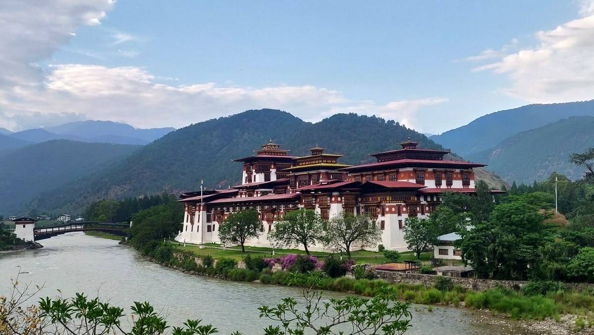
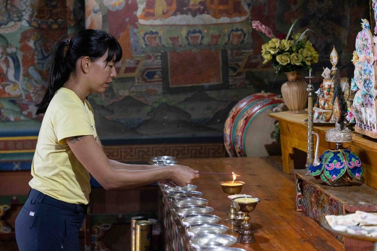
Today, enjoy a full day of rest in the beautiful and charming town of Punakha starting with a visit to Punakha Dzong (fortress) which rests majestically across the Bazam (bridge). Once on the other side, enjoy a tour of the Dzong (fortress), which was built by Zhabdrung Ngawang Namgyal in around 1637 at the confluence of the Phochhu (male river) and the Mochhu (female river). Arguably, it is the most beautiful Dzong in the country. The Dzong guards Bhutan’s most treasured relic, the Rangjung Kharsapani, an image of Chenresig kept away from the public in the utse (tower). It has survived Tibetan invasions, numerous fires, floods and a glacial lake burst. The Dzong served as the capital and seat of the Bhutanese Government until the early 1950s; and the coronation of His Majesty the First Druk, Gyalpo Ugyen Wangchuck, took place here. The building currently serves as the winter residence for the monastic body.
Included Activities:
Accommodation: The Four Boutique or similar (3*)
After breakfast at your hotel, rejoin the trail, this time heading east towards Lingmukha. Initially, the trail winds through paddy fields and then climbs relatively steeply until reaching a chorten (stupa) which marks the highest point on today’s hike. Enjoy a picnic lunch and scenic views of the valleys to the north here.
After lunch, the trail leads into the pretty Lingmukha valley, with the last hour or so of today’s hike being along the feeder road. The valley is commonly referred to as Lingmup Sher gi Zhom, which translates as “the golden bowl”, on account of the many rice fields which lie beneath ridges to either side. Here, you will visit the Lingmukha Lhakhang (temple), built by the great discoverer of treasure Terton Dorjee Lingpa. Oral tradition has it that Dorjee Lingpa arrived in Lingmukha in the 4th century, built the Lhakhang and then settled there along with his disciples. The Great Master is said to have discovered many ters (treasures) in the village.
After your visit to the temple, head to your campsite. A dinner prepared from organic, locally-sourced produce will be provided at camp.
Included Activities:
Accommodation: Deluxe Camping
After breakfast at camp, rejoin the trail heading east towards Samtengang. Historically, this section of the trail would have often been used by natives of Lingmukha and the people of Phangyul in the adjacent valley. Although the two villages are separated by a steep ridge, they strongly believe themselves to be close blood relatives who share the same cultural roots. The trail rises from deep in the Lingmukha Valley, climbing steeply through dense forest until it reaches a rest stop built at a ridge-top. From the ridge-top, you will descend sharply, enjoying panoramic views of the Shar Valleys. Stop on the way to visit the Chungse Azhe Gyalzom Lhakhang (temple) if time permits, which is built on the place where a Chan-do (a small, disc-like stone), thrown by the Divine Madman, Lam Drukpa Kuenley from Sha Kuenzangling on the other side of the valley, is said to have landed. Nearby, in the small village of Chungseykha, you will enjoy a hot lunch served in a local restaurant.
After lunch, the trail will pass by small farming villages perched on steep slopes and Lhakhang Thangkha (temple) as it climbs towards Samtengang, where you will find your campsite set up for overnight. This temple is thought to be one of the eight lings (meditation and teaching locations) of Kunkhyen Longchen Rabjam.
At the campsite, enjoy a dinner prepared from organic, locally-sourced produce will be provided.
Included Activities:
Accommodation: Deluxe Camping
After breakfast at camp, head out on what is a historically very significant section of the trail once used by the famous messenger Garp Lunghi Khorlo and the famous Chamberlin Pemi Tshewang Tashi. It is also an isolated section which passes through no human settlements, allowing you to be at one with nature for the duration of the day. As you head out of Samtengang, the first section of the trail is an ascent, after which the trail flattens out before dropping down towards Razawo at the end of the day. At Razawo, visit the chorten (stupa), thought to have been built in the time of Buddha Kashyapa and to be one of the oldest in Bhutan.
Head to your campsite after visiting the chorten. A dinner prepared from organic, locally-sourced produce will be provided.
Included Activities:
Accommodation: Deluxe Camping
After breakfast at camp, head out on the trail, which follows the river for a short while after leaving Razawo. From here, the remainder of the day involves a sustained climb towards the Pelela (mountain Pass). The trail will initially follow a farm road before crossing over into open meadow and forests of oak and walnut with the trail leading towards Rida village. The most important part of this village is the temple with the main relic being Sangay Tsepadme, the Buddha of Longevity, cast in bronze, which faces Pelela. Legend says that this statue was built by a young monk, the son of a local infertile couple who were blessed with the child by a tesmpa (Buddhist practitioner) in return for their kindness.
From the temple, the trail climbs up to Pelela through charming rhododendron forest. At 3,413 metres (11,198 feet) above sea level, the Pass is one of Bhutan’s highest and is traditionally considered the boundary between west and central Bhutan. Local craftspeople often sell fine yak-hair products at the roadside here.
Enjoy a picnic lunch at the Pass and then continue back on the trail descending down to the meadows of Longtey below Pelela. Upon arrival, head to your campsite and you will be able to enjoy a dinner prepared from organic, locally-sourced produce will be provided.
Included Activities:
Accommodation: Deluxe Camping
After breakfast at your camp, head back on to the Trans Bhutan Trail. As you descend through the meadows, keep an eye out for the remote yak herder camps which can be seen scattered around the valley. Stop in a traditional farmhouse in the village of Rukubji to enjoy a hot lunch, before visiting Rukubji’s village Lhakhang (temple), also known as Kuenzang Choling. It is thought that this temple was built some 300 years ago by a Lama named Tshendhen Duelwa. Unlike most temples, it is not built on a ridge with a view out over a valley, but rather on an extended plateau and close to two rivers: the reason for this is that the Lama is said to have built the temple on top of the head of a snake-demoness which he subdued in the same location. Rukubji is also famous for its unique local language, and you will have the chance to learn about it from the villagers over tea. The dialect, called Ngyen-Kye, is a mix of other dialects from across Bhutan and even some English words, and is now only spoken by a dozen or so households.
In the afternoon, rejoin the trail for a gentle climb out of the valley and through a forest, before dropping back down to the village of Chendebji, where you will camp for the night. At Chendebji, visit the Chorten (stupa), which is built at the point on which it is believed that the three ridges and the three edges of the sky meet. The Chorten was built by Lam Ngedup Tshering Wangchuk in order to subdue a local demoness, Nyala Dudm, and bring peace to the Chendebji Valley.
Enjoy a locally-sourced organic dinner at the campsite.
Please Note: Access to the second half of the trail is subject to seasonal conditions and local wildlife activity. During certain times of the year, the route may be temporarily restricted due to the presence of mother tigers and their cubs in the area, or because of poor trail conditions resulting from weather and terrain. In such cases, the hike may be shortened or an alternative route may be recommended to ensure the safety of all visitors.
Included Activities:
Accommodation: Deluxe Camping
After breakfast at your camp, rejoin the trail at the Chendebji Chorten (stupa). You will follow the old East-West National Highway for a short while, before heading back deep into the countryside towards the village of Tangsibji. A hot lunch will be served at a farmhouse in Tangsibji.
Today, the trail route passes the sites of several hydroelectric projects. These clean, renewable energy projects are one of the ways in which Bhutan has achieved its status as the only carbon negative country in the world. Bhutan also exports large amounts of green energy to neighbouring India. You will also have the chance to visit the Trashichoeling Lhakhang (temple), located in Trashiling village. The temple was built in 2002 as an offering to His Majesty the Fourth King of Bhutan by His Holiness the 70th Je Khenpo.
On arrival in Tshangkha, time permitting visit the Tshangkha Lhakhang (temple) before heading to your campsite. The ground on which the temple stands is thought to have been first blessed on an unknown date by Lopen Golay of Tshangkha, who gained his wisdom and power from the mantras of the Mindroling monastery in Tibet. The first structure was built here in 1701 by Choezang, who served as the Trongsa Chamberlain, and the site now provides a venue for both social and religious community gatherings.
After your visit, enjoy a locally-sourced organic dinner at the campsite.
Please Note: Access to this entire section of the trail is subject to seasonal conditions and local wildlife activity. During certain times of the year, the route may be temporarily restricted due to the presence of mother tigers and their cubs in the area, or because of poor trail conditions resulting from weather and terrain. In such cases, the hike may be shortened or an alternative route may be recommended to ensure the safety of all visitors.
Included Activities:
Accommodation: Deluxe Camping
After breakfast at your camp, head back out onto the trail for the short, steep climb out of Tshangkha, past the Ugyen Choling and Tsangkha Sheydra. The Trail then drops back down towards the National Highway, which it crosses at the Trongsa viewpoint.
Trongsa is Bhutan’s geographical center point and is very closely linked to the Bhutanese Royal Family: the first two hereditary Kings ruled from Trongsa Dzong (fortress) and the crown prince still traditionally serves as the Penlop (Governor) of Trongsa before acceding to the throne. The Trans Bhutan Trail still passes directly through the middle of the city of Trongsa and, in centuries gone by, the trail would actually have passed right through Trongsa Dzong itself. Today you will recreate the experience of arriving at this powerful city on foot in the same way the garps (messengers) would have done centuries ago, as you descend into the steep valley below the viewpoint, enjoying spectacular views of the Dzong (fortress) on the opposite side. At the bottom of the valley, you will cross the old cantilever bridge over the Mangde River before heading up the other side of the valley and entering Trongsa Dzong (fortress) via the Western gate.
After lunch in a local restaurant, enjoy a tour of Trongsa Dzong (fortress) and head back on the trail for a gradual climb towards Kewathang where you will end your hike for the day.
The Trongsa Dzong (fortress) was first built by Wangchuck as a small meditation room in 1541, after he discovered self-manifested hoof- prints belonging to the deity Pelden Lhamo on the same spot. Trongsa, which means ‘new village’ in the local dialect, soon sprung up around the site. The Dzong (fortress) was built in its present form in 1644 and then enlarged again at the end of the 17th century. It is home to some 450 district monks who spend their winters in Trongsa and their summers in Bumthang. You will visit a selection of the Dzong’s 23 lhakhangs (temples), before heading to the Trongsa Ta Dzong (watchtower), which now houses the interesting Royal Heritage Museum.
The remainder of the day will be at leisure to relax, before enjoying dinner with your guide at a local restaurant in the early evening.
Please Note: Access to the first half of the trail is subject to seasonal conditions and local wildlife activity. During certain times of the year, the route may be temporarily restricted due to the presence of mother tigers and their cubs in the area, or because of poor trail conditions resulting from weather and terrain. In such cases, the hike may be shortened or an alternative route may be recommended to ensure the safety of all visitors.
Included Activities:
Accommodation: Deluxe Camping
After breakfast at your hotel, bid farewell to Trongsa, as you head back out on the trail for a gradual climb up towards Yotongla (mountain Pass). Today’s trek crosses a number of ecological zones and so is particularly rewarding for birdwatchers. From Kewathang, the trail cuts through dense forest until it reaches the Pass. Enjoy a picnic lunch en route.
From Yotongla, the trail descends through meadows and open forest until it meets the Geytsa River. The last stretch for today is a pleasant riverside walk towards Geytsa passing by the Chuchi Lhakhang (temple). Whilst there are no official records of when this temple was built, locals claim that it was one of the 108 temples built across the Himalayan region by King Songsten Gampo in the 10th century.
Enjoy a warm dinner this evening at the hotel with your guide.
Included Activities:
Accommodation: Chumey Nature Resort or similar (3*)
After breakfast, head out on to a historic section of the trail which would traditionally have been used by the Royal family when they transferred between Trongsa and Bumthang or Bumthang and Kuenga Rabten, where His Majesty the Second King had his summer residence. From Geytsa, the trail rises through pine forests towards the Pass at Kikila, where the trail briefly follows the route of the Owl Trek.
From Kiklia, the trail descends gently into the Bumthang Valley, offering spectacular views of Jakar Dzong (fortress) on the way down.
Dinner this evening will be at the hotel with your guide.
Included Activities:
Accommodation: Yugharling Resort or similar (3*)
After breakfast at your hotel, head east out of Bumthang through the beautiful and charming town of Chamkhar before climbing up to Badhala enjoying spectacular views of Lhodrak Karchu Dratsang (monastery). The monastery is one of the most important in Bhutan. It is believed to have been founded in 1984 by Namkhai Nyingpo Rinpoche, a descendent of a Tibetan lama whose spiritual lineage can be traced back to one of the close disciples of the great Buddhist Guru Padmasambhava. Originally, the two-story monastery was large enough to accommodate 70 monks, but has since grown considerably and is now home to over 400. The building houses a huge assembly hall with imposing statues of Guru Rinpoche and a beautiful terrace with breathtaking views of the Chhokhor Valley and Jakar Dzong.
The trail begins to descend after Badhala as you are approaching the village of Babzur and continue towards the Pema Choling Nunnery. Women and girls who enrol here follow a nine-year course in the Nyingma Peling Buddhist tradition and are known for a particular drum ceremony known as “chod”.
After your visit to the nunnery, the trail continues south towards the sacred Mebartsho (burning Lake), where, in the 15th century, the great treasure hunter Pema Lingpa is said to have discovered several of Guru Rinpoche’s hidden treasures. Lingpa had a dream in which he was summoned to this particular location on the Tang River and, when he arrived, he saw at the bottom of the river a temple with many doors, one of which was open. He then swam down into a large cave where he was handed a treasure chest by a one-eyed woman. He would later repeat the feat in the presence of the local people and whilst holding a lit butter lamp which did not go out underwater – and it is because of that that this pool was named “burning lake”.
Enjoy a nice outdoor picnic lunch before heading back towards your hotel.
Included Activities:
Accommodation: Yugharling Resort or similar (3*)
Today, enjoy a full day of rest in the town of Bumthang.
Start of the day with a visit to the majestic Jakar Dzong (fortress), also known as the ‘Castle of the White Bird’. This huge structure dominates the Chamkhar Valley and the town below it. It was built in 1549 by the Tibetan Lam Nagi Wangchuk and was Eastern Bhutan’s main defensive stronghold. Later, it became the seat of the First King of Bhutan. Unique features include its fifty-metre utse (tower) and a sheltered passage with two parallel walls, interconnected by fortified towers, which guaranteed the fortress’s inhabitants access to water during a siege.
While in Jakar, also take the chance to visit one the oldest temple to have been built in Bhutan; The 7th century Tibetan king Songsten Gampo is said to have built 108 temples in one day and Jambay Lhakhang (temple) in Bumthang is believed to be one of them. The Jambay Lhakhang Drup (festival) is one of the most interesting events held there. During this festival, the chams (dances) include Terchham (Naked Dance), which was formerly initiated by Terton Dorje Lingpa, Mewang, Macham, Ging Tsholing, Dramtse Ngacham, Zhana Cham etc. The dances are performed by the local villagers of Norgang, Changwa and Nangsiphel.
Then continue further into the valley across farmlands towards Kurjey Lhakhang (temple). Kurjey Lhakhang is made up of three temples: the one on the right was built in 1652 against the rock face where Guru Padmasambhava meditated in the 8th century; and the middle temple, considered the most holy, is built on the site of a cave containing a rock with the imprint of the Guru’s body.
Included Activities:
Accommodation: Yugharling Resort or similar (3*)
After breakfast at the hotel, rejoin the trail and head southwest towards the valley of Ura. The trail follows the old East-West highway for a short while before cutting back into the rolling countryside, passing fields of buckwheat. Enjoy a picnic lunch near the village of Tangsibi where you will rest before taking on the switchback climb towards the Sheytangla Chorten (stupa) – the views of the Ura valley from here are fantastic. From the Chorten, descend down into the valley towards Ura.
Included Activities:
Accommodation: Local Farmhouse
After breakfast, head out for a visit to the Ura Lhakhang (temple). Built in 1982, its main statue is a two-story Guru. According to locals, another, human-size copper Guru housed in the temple was responsible for saving the Valley from the spread of chronic leprosy in the past.
After visiting the temple, continue your trek through the beautiful Ura Valley as you head up towards Wangthangla (mountain Pass). This challenging section climbs through the beautifully scenic Phrumsengla National Park, a vast nature reserve whose tree-clad mountains give sanctuary to red pandas, tigers, and rare birdlife. After a picnic lunch, descend towards Gayzamchu, where you will camp for the night.
On arrival at the campsite, enjoy a hot shower, and a locally-sourced organic dinner.
Included Activities:
Accommodation: Deluxe Camping
After breakfast at camp, hit the trail for another challenging day climbing up through the Phrumsengla National Park towards the Pass at Thrimshingla. From Gayzamchu, the trail climbs up through rhododendron forests – keep an eye out for the elusive and rare red panda as you walk. After a picnic lunch, descend from Thrimshingla through dense forest and past herders’ camps to Sengor, from where you can enjoy stunning valley views.
You will spend the night camping at Sengor – on arrival at the campsite you will be invited to enjoy a hot shower, and a locally-sourced organic dinner.
Included Activities:
Accommodation: Deluxe Camping
After breakfast at camp, head down the gentle slope into the Sengor valley passing by the Sengor Lhakhang (temple) and through dense forest on your way to Latongla. The temple is believed to be hundreds of years old. Some believe that it was built by the First Patseling Trulku Drubtob Namgyel Lhundrub at some stage in the 18th century.
The trail passes through with today’s section of the trail passes through greatly varying vegetation and is a real chance to wonder at Bhutan’s diversity and natural beauty. For most of the day, you will be accompanied by the sound of the Phangphangla waterfall in the distance.
Today’s walk involves three ford crossings and your guide will be sure to check local conditions.
You will spend the night camping at Latonga – on arrival at the campsite your crew will invite you to enjoy a hot shower, and a locally-sourced organic dinner.
Included Activities:
Accommodation: Deluxe Camping
After breakfast at camp, rejoin the trail for a steep descent through dense forest. You can expect a vertical descent of around 2 kilometres (1.25 miles) over 10 kilometres (6.21 mile) stretch today, and you will feel the climate get noticeably warmer as you go along. Many sections of the descent make use of dry-stone staircases installed by the ancestors and serve as a reminder of a time when the trail would have bustled with traders, pilgrims and messengers.
The trail also passes through the spectacularly mystical ruins of Zhongar Dzong (fortress). The Dzong was probably destroyed by fire and an earthquake which is said to have lasted days, but, according to myth, its demise was the result of a curse brought upon it by its own architect, Zochhen Bala. Fearful that Bala might try to replicate the design he had commissioned elsewhere, the King is said to have had him killed; but Bala was then reborn as an evil serpent who, it is believed, still resides beneath the fortress’s foundations.
You will spend the night camping at Lingmithang – on arrival at the campsite your crew will invite you to enjoy a hot shower, and a locally-sourced organic dinner.
Included Activities:
Accommodation: Deluxe Camping
After breakfast at camp, head east towards the town of Mongar. Much of the early part of the day will follow the East-West highway as far as the Kuri River. From Kuri Zampa, the trail then cuts back into dense forest and climbs sharply up towards Mongar.
On arrival in Mongar, if time permits, visit the Mongar Dzong (fortress), the town’s most imposing landmark. Built in 1930, the building serves both as the district administrative headquarters and as the home of the monastic body. Within the fortress there is a monastery which provides young monks, particularly those from rural areas, with accommodation and food and provides an opportunity to pursue a spiritual education.
Afterwards, check into your hotel before enjoying dinner with your guide at a local restaurant.
Included Activities:
Accommodation: Wangchuk Hotel or similar (3*)
After breakfast at your hotel, head east out of Mongar towards Ngatshang. Today will be spent climbing up towards the Pass at Korila, passing through the villages of Wengkhar and Themdangbi on your way.
At Korila, stop for a picnic lunch at a sacred place known as Wadipa Nye, just above the Pass. There is a statue of Guru Rinpoche here to commemorate the spot where, in the 7th century, a cow herder spotted Guru meditating, and offered him milk. An annual festival is held at this location, during which locals will place their hands underneath a rock: if their hand emerges holding animal fur, it is believed they will be blessed with great prosperity.
Tonight, you will spend the night camping near Korila – on arrival at the campsite your crew will invite you to enjoy a hot shower, and a locally-sourced organic dinner.
Included Activities:
Accommodation: Deluxe Camping
After breakfast at camp, rejoin the trail as it descends towards Ngatshang where, on arrival, you will be able to visit the Jarong Khasor Stupa. Some locals believe that a bend in the first base floor of the stupa was caused by the spiritual impurities of the dead body of the Trashigang Dzongpon, which rested on the stupa on its way back to Trashigang to be laid to rest.
Then, pushing further east, descending through sub-tropical forests as far as the village of Sherizampa.
On arrival at Sherizampa, head to your campsite where your crew will invite you to relax with a hot shower, and a delicious, locally-sourced organic dinner.
Included Activities:
Accommodation: Deluxe Camping
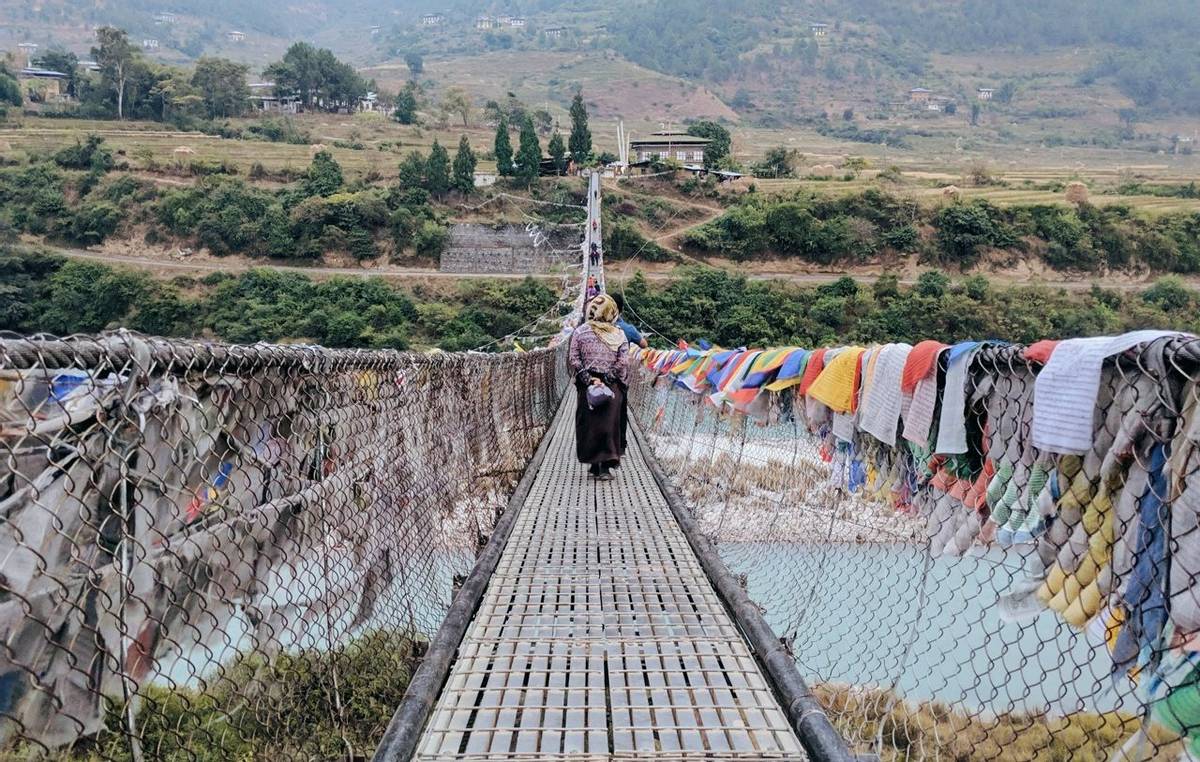
After breakfast at camp, cross the old suspension bridge and follow the trail as it climbs back up through forests of pine and lemongrass and along ridges with breath-taking vistas.
From Baginla, where you will stop for lunch, the trail rises gently until it reaches Drametse. Take a short detour to visit the Drametse Lhakhang (temple), built in the 16th century by Ani Cheten Zangmo, the granddaughter of Terton Pema Lingpa. Ani Cheten Zangmo fled here from Bumthang to escape the marriage proposal of a local king and found this site suitable for meditation. It was named Drametse, which means ‘the peak without enemies. Drametse is considered the main seat of Terton Pema Lingpa’s lineage and also the religious and cultural center for eastern Bhutan.
On arrival, head to your campsite where your crew will invite you to relax with a hot shower and a delicious, locally-sourced organic dinner.
Included Activities:
Accommodation: Deluxe Camping
After breakfast with your hosts, head back out onto the trail as it descends steeply from Drametse past the village of Bazur, where you will visit the Bazur Lhakhang (temple). Prior to the reign of His Majesty the Third King of Bhutan, the temple had been used to store royal grain supplies, but was then restored to a temple at the request of one of the workers.
From Bazur, the trail climbs a steep ridge before reaching Narang, where you will stop for lunch.
From Narang, follow the trail down through the village towards Durung, which lies on the boundary between the Mongar and Trashigang districts. Cross the river and pay a short visit to the community temple of Dongnga Choeling. From there, the trail continues up towards Gongthung.
On arrival in Gongthung, visit the Jarong Khashor Stupa, a Nepalese-style stupa which was built during the visit of a lama from who came all the way from Pemakhue (now the Indian state of Arunachal Pradesh).
After your visits, head to the campsite where your crew will invite you to relax with a hot shower, and a delicious, locally-sourced organic dinner.
Included Activities:
Accommodation: Deluxe Camping
After breakfast at camp, set out on the Trans Bhutan Trail for one final day of trekking, having covered nearly 400 kilometres (249 miles) since you set out from Haa one month ago!
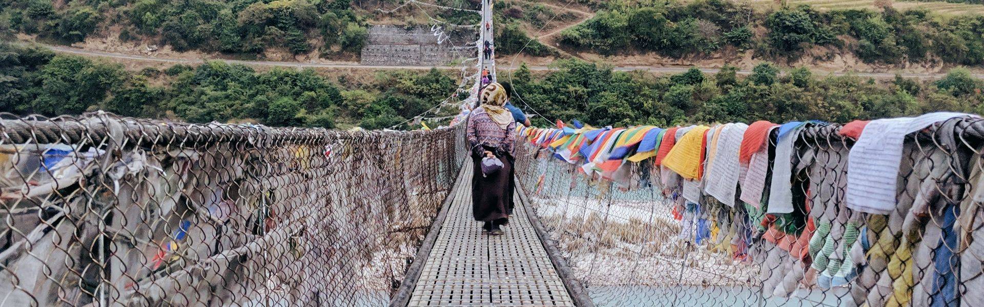
From the Jarong Khashor Stupa at Gongthung, the trail descends through numerous small villages as far as Chazam, the bridge which crosses the Dangmechhu River and leads into Trashigang on the other side. All along the way, you will enjoy fine views of Trashigang Dzong (fortress) in the distance.
Trashigang Dzong (fortress) will be your final stop on this incredible journey from west to east. Check into your hotel and then head out to visit the Trashigang Dzong (fortress). Built in 1659 atop a ledge with steep cliffs on three sides, the building overlooks the Dangme and Gamri rivers. It is said that Zhabdrung Ngawang Namgyal prophesied the construction of this fortress and so ordered Trongsa Penlop Minjur Tempa to engage local chieftains to construct it. Local stories suggest that the Tibetan army was so frightened at the sight of the Dzong that they retreated when they reached the banks of the river Dangme.
In the early evening, head out with your guide for a meal at a local restaurant to celebrate your incredible achievement.
Included Activities:
Accommodation: Lingkhar Lodge or similar (3*)
After breakfast at your hotel, head to the nearby Yonphula airport for your domestic flight back to Paro.
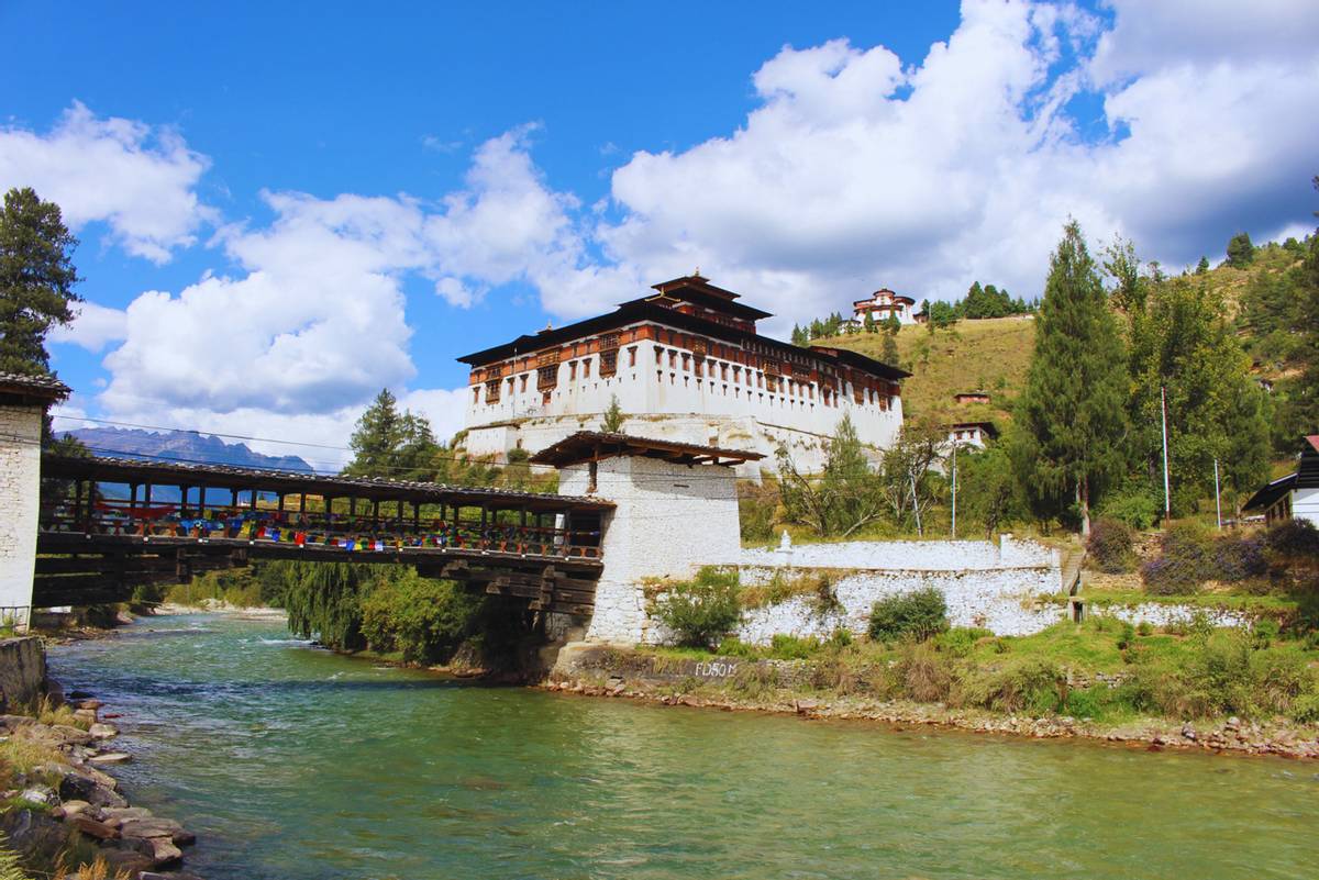
On arrival in Paro, visit Ta Dzong or the ‘watchtower’, originally built in 1649 to protect Paro Dzong from the Tibetan military. In 1968, Ta Dzong became Bhutan’s National Museum, and is now home to a number of exhibitions including sculpture, painting and artifacts depicting Bhutan’s magical past. Afterwards, continue to the stunning Paro Rinpung Dzong (fortress), meaning ‘Fortress on a Heap of Jewels’. The original construction of this Dzong is believed to have been completed in 1458 and it was restored to its present glory by His Majesty the Third of Bhutan, King Jigme Dorji Wangchuck, to mark his royal wedding in 1951.
After the visit, head to your hotel and enjoy the remainder of the at leisure.
Included Activities:
Accommodation: Metta Resort & Spa or similar (3*)
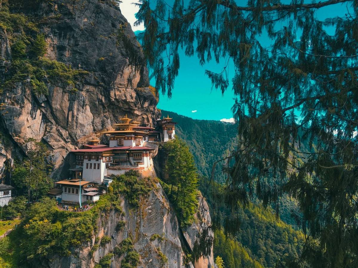
After breakfast this morning, head northwest out of Paro by private vehicle for a visit to the iconic Taktshang Goemba, more commonly known as the ‘Tiger’s Nest Monastery’. Precariously perched on a sheer cliff face 900 metres (2,950 feet) above the Paro Valley floor, the Tiger’s Nest is undoubtedly Bhutan’s most famous religious building. It is built on the site where Guru Rinpoche is said to have arrived on the back of a tigress when he came to subdue the local demon, Singye Samdrup. After subduing the demon, Guru Rinpoche is said to have meditated in a cave here for three whole months.
The Monastery is only accessible by foot via a 2 to 3 hours hike up the valley side. The trek offers spectacular views from the ridge and passes a small chorten, a basic monastery, and a waterfall on its way.
Once you have reached the Tiger’s Nest, you will have a chance to visit the cave where Guru Rinpoche meditated, as well as the extensive network of Lhakhangs (chapels) which house images, murals, chortens, and a holy spring. You may also wish to make a diversion to the attractive Machig-phu Lhakhang (temple) on the way back down to the access road.
After the visit, you will head back to your hotel in Paro.
Included Activities:
Accommodation: Metta Resort & Spa or similar (3*)
After breakfast at hotel, head out for a visit to Kichu Lhakhang (temple). Said to date from the 7th century and built by Songtsen Gampo, it is one of Bhutan’s oldest religious sites. Kichu Lhakhang is home to an original statue of Jowo Jamba which is one of the most sacred sculptures in the region; and the two orange trees inside the monastery courtyard are said to bear fruit year-round.
Followed by the visit, drive to the city center and talk stroll along through the beautiful town of Paro. Before heading back to hotel, we recommend you relax and unwind after your long trek with a traditional Bhutanese hot stone bath.
This evening, enjoy a memorable farewell dinner and cultural show with your guide at a local restaurant, during which you will be able to share memories and celebrate having successfully completed one of the world’s greatest walks.
Included Activities:
Accommodation: Metta Resort & Spa or similar (3*)
After breakfast this morning, you will be transferred to the airport for your international departure flight.
The Trans Bhutan Trail is a not-for-profit social and tourism enterprise. 100% of the profits go back into maintaining the Trail and supporting communities and individuals along the route. Travelling with us is the best way to support our mission. Please also consider becoming a member or making a donation through one of our charitable partners.
Cookie Policy
We use cookies to ensure that we give you the best experience on our website. If you continue to use this site we will assume that you are happy with this.